History of our Towns and Villages
Warialda, Bingara, Gravesend, Cootatai, Crooble, Warialda Rail, Cobbadah, North Star, Croppa Creek and Upper Horton make up the towns in the Gwydir Shire. Here we have a short history on each of the villages.
BINGARA – The discovery of gold in 1852 brought prospectors to the area. In the 1880’s, copper and diamonds were discovered also, causing a rapid development of the town. Bingara is one of the few places in Australia where diamonds have been found. In fact, Bingara was the largest producer of diamonds in Australia at that time.
WARIALDA - Warialda “Place of Wild Honey” derived its name from the “Weraerai” people who frequented the area.
Allan Cunningham and his five men John Smith, James Swainbro, Thomas Hadfield, John Lane and Duncan Kennedy were the first white men to explore and map the area in May 1827. The brief from the Governor to Cunningham was to travel north staying between the 27th and 29th meridian.
The exploration party set out from Segenhoe near Scone with rations, 11 pack horses and several dogs. The men had been supplied with 3 blankets and 6 pairs of boots from the crown. The party travelled through the Liverpool Plains and Gwydir District to Cunningham’s Gap in Queensland.
Unable to find a pass over the range the group was forced to return to Segenhoe. On the upward journey, Cunningham set up camp just west of Warialda, now called Cunningham’s Rest and the return saw the party camped a few miles to the east of Warialda on Reedy Creek.
Cunningham’s exploration opened up vast tracts of land and it was not long before Pastoralists from the Hawkesbury and Hunter Valley area began occupying large areas of grazing land. The area of 1157 miles was too large to be administered by Edward Mayne who was stationed at Scone. Law and order being out of control and annual rent from the runs had to be collected, the crown appointed Captain Robert Mayne as Magistrate on 19 June 1839 and told him to report immediately to Reedy Creek Warialda.
Mayne established the Border Police outpost at Warialda in the area of Captain Cook Park. Warialda became the first administrative centre for the Gwydir District. John Galloway surveyed and designed the township with the plan being accepted and gazetted on 21 June 1850. Census taken in the Warialda district in 1856 showed 773 Males, and 267 Females.
Agriculture is the industry that sustains the town and wider area to this day. The rich alluvial Gwydir River flats to the west and the black soil plains to the northern region produce some of the countries finest grains. Sheep, wool and cattle production add high quality and significant value to the agricultural industry.
GRAVESEND was created as a village by transport and proclaimed a village in 1911. The Warialda Standard, 2 October 1911 announced that ‘Atkin Hill’ was to be subdivided at Warialda Railway.
The Department of Lands altered the design of Gravesend by extending the village and suburban limits in 1915. The proclamation was gazetted on 16 December 1915. In October 1917 fifty-nine allotments in the village were offered for sale. In April 1936 the Gravesend Progress Association discussed the tarring of the main street. In 1971 Gravesend obtained water from a bore in the bed of the Gwydir River.
A receiving office was established at Gravesend railway station on 1 February 1900 under the charge of Thomas Edwards, railway office in charge. On 16 April a post and telegraph office was established at Gravesend in lieu of the present receiving station.
In February 1900, Gunthorpe started the Royal Mail Coach service from Warialda to Gravesend. The business also advertised '26 hours to Sydney’. After the arrival of the train to Gravesend, Gunthorpe advertised a five horse special to leave Gravesend five minutes after arrival of the train. The mail coach then left later with luggage.
Events – The small population of Gravesend, home to the notorious boothill bucking horses and “Hat Trick”, Gravesend’s own champion bucking bull, swells when the rodeo is in town. Held in February each year Gravesend Rodeo provides a day of enjoyment and thrills for the whole family.
UPPER HORTON – Allan Cunningham discovered the Horton River in July 1827. An early run was ‘Eulorie’ with an area of 40,960 acres, occupied by Parnell until 1851 when it was transferred to Rawdon McDouall. He held it until 1855 when it was taken over by the King family.
Other runs included Archibald’s run ‘Ulumbarella’, some 24,000 acres by 1848 and ‘Currangandi’, a run of 22,400 acres occupied by Letherbridge. As more settlers arrived a community developed and a village was proclaimed in 1896. The area became known as Upper Horton, a school was established in 1883 and the area became an important coach stop linking roads from Bingara, Barraba, Moree and Narrabri. The horses were changed at ‘Currangandi’.
In time, a mail receiving office was established at John Gainen’s hotel in October 1890; a bakery and butcher-shop at the hotel; churches, stores, blacksmith, bakeries, saddlery and police station. Later it had a garage and car hire service, golf course, tennis courts, racecourse, tennis, cricket and football teams. Local identity E.L. Bates referred to the village as Old Horton and stated that by 1907 it ‘consisted of a little more than a few homes, one shop, Post Office, Police Station, school, blacksmith and saddler, as well as a hotel kept by one, John Gainen’.
Events – The major event of the village of Upper Horton is the very popular and highly regarded New Years Day Rodeo.
COBBADAH – In January 1901 a petition seeking the establishment of a Provisional School at Cobbadah was forwarded to the Department of Public Instruction. In the petition it was revealed that Cobbadah was a surveyed township with a post office. Surveyor Thomas J. Oliver completed a preliminary survey for the town during April 1863. A surveyed block in the town for a school site was dedicated on 1 June 1865. A rough plan, which accompanied the petition showed that the Post Office was located alongside the ‘Cobbadah Hotel’, conducted by George Wilkinson, and the dedicated school was, situated further north on the Bingara Road.
The reserved portions set aside for the town and suburban lands appeared in the NSW Government Gazette, 24 November 1865. By 1909 parishioners of the Anglican Church prayed in the Church of the Annunciation. The design of Cobbadah was modified and on 16 February 1910, the new plan was published in the NSW Government Gazette. The area excluded from the town site was made available for rural settlement. This area now forms part of portion 53. A further sale of allotments within sections 8, 9, 10, 11 and 19 took place on 28 September 1910.
At the time of writing her history, Betty Crowley reported that only five buildings stood within the original town- the church, Post Office, two farm houses and a deserted hut. Other features of the historical landscape included foundation blocks, a solitary chimney, several domes of old wells and a clump of fruit trees.
COOLATAI – The Coolatai Village was surveyed in 1902. Early blocks were held by H.W. Reeves (Portion 42), Edward Parr, H.E. Kimmorley, W.H. Reeves and J.A. Coughlin. Contractor Fred Beck erected the hotel for Edward Parr and the first licensee was William J. Parr in 1903. In May 1911 the license was transferred from Matt Lowe to Frank Marshall and in May 1913 W.H. Irwin took the hotel over from Marshall. There were two stores. One was erected for Edward Parr by E. Parr and workmates. The other store (now the public hall) was erected for Harry Kimmorley by Jacob Ernst. The owners completed both in 1903. The correspondent writing in TheInverell Times, 2 April 1903 described construction of the hotel by E. Parr consisting of ‘ten bedrooms, dining room, bathroom, kitchen and necessary outhouse’. Mention was also made of the general store under construction by H. Kimmerloy. The first Post Office was a room in Harry Kimmorley’s store in 1903. It was moved to Edward Parr’s store in 1906.
Fred Beck erected the first school in the present school grounds at the eastern boundary in 1901. The school was previously housed in private buildings on ‘Colootai Station’, later ‘J.E. Kimmorley’s, ‘Kargorum Station’. The school site was dedicated on 2 August 1902. The Inverell Times, 22 April 1903 stated that the ‘Department of Public Instruction have erected a new school capable of holding some 40 children’.
The first Jockey Club was formed at Coolatai in about 1905 with races over the creek on the common. The Sports Ground was used from about 1906 with athletic sports and bridle races. The Race Club was still in operation in April 1916. The cemetery was notified by the Lands Department on 27 January 1910.
CROOBLE– was proclaimed a village in 1940. D Magill has prepared the following outline of Crooble showing the people, buildings and businesses at Crooble as at 1958:
Public school and playground fixtures; post office with residence which operated the telephone exchange and a convenience store; Atlantic fuel deport; B.P. fuel depot; stock and station agent; grain agent; railway station; water dam and water tanks centre for steam train; stockyards for loading cattle and sheep; bag stacks for holding grain; cricket club with club house; hall and tennis courts still in existence; silo terminal; passenger train from Moree delivered goods three times a week; Baby Clinic Sister came by train- kept records and offered advice to mother and babies.
Crooble is located approximately 50km by road north west of Warialda, 45km north east of Moree and 35km north of the Gwydir Highway via Pallamallawa. Access from all directions is via roads with unsealed sections.
The village is isolated and not on any through or linking route. The village has a few houses, grain silo and a community hall. There are no shops or visitor facilities.
CROPPA CREEK – was proclaimed a village on 7 June 1940 and the village boundaries established that month. Croppa Creek is located approximately 15km north of Crooble, on Croppa Creek Road. Croppa Creek Road is a loop off the Newell Highway 25km north of Moree, which accesses Croppa Creek and North Star before rejoining the Highway at Boggabilla. The last remaining section of gravel on this route is currently being sealed. Croppa Creek village is located 2km off the road, but is visible from the road.
The village is a ‘silo town’ which has a few houses (9 families), General Store, Sports Club (open Friday, Saturday and Sundays from 5pm), 9 hole golf course, tennis courts, oval/cricket pitch, school and community hall. The General Store is also the post office, takeaway, petrol station and liquor outlet. The Store trades 7 days per week and is well presented, with attractive landscaping and an undercover outdoor dining area.
Croppa Creek Road loop is an alternative to the Newell Highway, although the road is a ‘bit bumpy’ and rough in places it does have low traffic volumes, with very few large trucks. The rural scenery and cropping activity along the route, with the area being a mosaic of colour at various times of the year, makes for a pleasant trip.
NORTH STAR – was created as a village by transport and proclaimed a village in 1928.
North Star is the northern most village in the Shire, being located approximately 75km north of Warialda and 50km south of Goondiwindi. The village is located on the Boggabilla Road which is the main route north from Warialda for travellers heading to central and far northern Queensland, to areas such as Carnarvon Gorge.
North Star also lies on the Croppa Creek Road which is a scenic alternative to the Newell Highway. North Star is one of the larger villages in the Shire, with facilities including a General Store, Sports Club, War Memorial Park, small caravan park, golf course, showground and polo ground. The Hotel is being upgraded and is looking to expand its accommodation base.
War Memorial Park is attractively presented with picnic facilities, barbeque, play equipment and toilets. Travellers often stop to use the Park toilets and other facilities with motorhomes and caravans occasionally staying overnight adjacent to the Park.
WARIALDA RAIL – A recreation reserve of fifteen acres was declared in August 1911. The secretary S. Robinson called tenders for fencing the reserve in January 1913 and in March the first use of the recreation ground at Kelly’s Gully took place. A permanent Common was dedicated on 18 March 1927. In April 1930 tenders were called for construction of a C.W.A. Hall. Sallway’s Estate consisting of a number of allotments near the railway station as well as grazing and farming sites were offered for sale in March 1914. Formerly known as Kelly’s Gully, the Warialda Historical Society has published ‘Reminiscences from 1910’ by Linda Balston as well as a story of Burgaria. The public school was originally known as Kelly’s Gully; the railway station as Warialda and the locals referred to the area as the Gully.
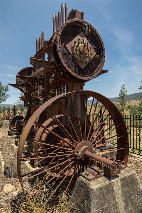
The railway station was located at Warialda Rail. Today a former hotel situated to the west of the platform, a cluster of houses, a railway yard and industrial heritage, steel lines, crane, sidings and a prominent wheat silo survive. In the mid 1970s a goods train came through every weekday and rail motors four days a week.
The Warialda Railway yard once included a crossing loop located in the Inverell end of the platform; two home signals on the approach from Moree (one to protect the platform and the other on the Inverell side to protect the crossing loop). The timber station building with its twin gables was situated opposite the goods siding, with its galvanised iron goods shed, hand crane and wool ramp.
Extensions served the stock-races (near the loop line) and a ‘back loading’ siding provided additional accommodation for wool and grain loadings. A short extension of this latter siding gave access to the bulk fuel depot of Shell Oil, opened on 3 February 1930; a bank of concrete silos was erected by the Grain Elevators Board in 1934 and a local business operated by H. Moore was provided with a special loading site in the yard after 1937.